Turn a Photo into a Contour-Line Island Map
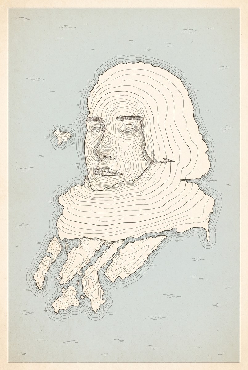
Transform a supplied photo into a vintage, single-sheet island map whose coastline follows the photo’s subject silhouette.
Example outputs
Prompt template
- Format
- Text
- Inputs
- Reference_photo (image) · Required
- Outputs
- Contour_line_island_map (image)
Use the uploaded photo as terrain and turn it into a single contour-line map. Output exactly one tall, portrait-oriented image.

MAP
Make it a one-sheet map printed by an old surveying office. The outer silhouette of the subject in the photo becomes the island’s coastline, and its most prominent point becomes the highest peak. Center the island, with sea all around it. The map is pressed onto paper, so the ink bleeds very slightly along the paper grain.

CONTOUR LINES
Draw many fine, nested lines connecting points of equal elevation. Space the lines more closely on steep slopes and farther apart on gentle slopes. Use at least eight nested lines from the peak to the coastline. Make every fifth line slightly thicker. Keep every line continuous and closed, returning to its own starting point. Use even, pen-drawn line weights; do not use brushstrokes or shading. On extremely steep, cliff-like areas, replace the contour lines with tightly spaced short hachures.

SEA
Fill the entire area outside the island with sea. Use one pale color as a filled area; do not leave it the uncolored paper. Draw three or four fine lines following the coastline, and indicate ripples only with short horizontal strokes.

WHAT TO TAKE FROM THE PHOTO
Follow the subject’s outer shape faithfully: protrusions become headlands, and indentations become bays. If there are multiple subjects, make the same number of separate islands and fill the spaces between them with sea. Areas that appear larger because they are closer to the camera are higher; distant or occluded areas are lower. Turn anything the subject is wearing or holding into terrain too, attached as small islands or sandbars. Replace the entire background with sea.

PAPER AND COLOR
Use no more than three colors: cream paper, one color for the lines, and one color for the sea. Let the edges of the paper look slightly faded. Do not carry over the photo’s colors.

FAILURE CONDITIONS
The result fails if even one letter, number, place name, scale, directional label, legend, signature, logo, or watermark appears anywhere. There must be zero of these. Fill areas where map text or numbers might normally appear with a few dots or short hachures; if any shape starts to look like a letter or number, leave that area as blank paper instead.
The result fails if it includes any conventional map accessory, such as a compass rose, compass, legend box, or scale bar. The paper must contain only the island, sea, and border line.
The result fails if any part of the photo’s texture remains photographic. Redraw skin, fur, fabric, metal, glass, petals, and everything else as lines.
The result fails if five or fewer contour layers are visible between the peak and coastline.
The result fails if shading or tonal modeling makes the image look three-dimensional. Show elevation only through the number of nested lines.
The result fails if the coastline becomes a generic rounded island unrelated to the photo. Preserve at least three prominent protrusions from the photo in the coastline; two or fewer is a failure.
The result fails if more than three colors are visible.
The result fails if grid lines, coordinate lines, or ruler marks are visible.
The result fails if the sea is uncolored and left as bare paper.
The result fails if the image is split into two parts, with the original photo or an explanation panel on one side. Show only the map.

IF EVERYTHING CANNOT BE FOLLOWED
Prioritize zero text and a coastline that follows the photo. If you cannot achieve the required number of contour layers, draw the island larger to create more room between the lines.

Output exactly one tall, portrait-oriented image.
What you'll create
The subject’s outline becomes a coastline surrounding a raised peak, nested with fine elevation lines. Slight ink bleed and old surveying-office paper character make the single tall map feel printed.
Usage instructions
Provide one photo containing the terrain or subject to transform. Its outline determines the island’s coastline, while contour lines express elevation. To make dense contour layers easier to show, follow the prompt’s instruction to draw the island larger while preserving its distinctive coastline.
Frequently asked questions
Are the contour lines evenly spaced everywhere?
No. They crowd steep slopes and separate on gentle ones.
Should an explanatory photo panel be added?
No. Only the map is shown.


Comments
Tried this prompt? Share what you made, compare results, or ask a question